Vine City & English Avenue: A Tale of Two Neighborhoods

https://www.artsatl.org/wp-content/uploads/innercityurban_01.jpg

For decades, “The Bluff” was the defining term for two historic downtown west neighborhoods that once stood tall amongst giants, like Dr. Martin Luther King, Jr., Maynard Jackson, and Julian Bond. English Avenue is historically significant, but her story includes decades disinvestment. It is now the focus of revitalization efforts.

 English Avenue, originally known as Western Heights, was established in 1891 as a white working-class neighborhood. Its name reflects its origins tied to the English family, and Simpson Road (now Joseph E. Boone Blvd) served as a racial dividing redline—white to the north, Black to the south.

Just south of that, Vine City emerged in the late 1800s as a predominantly African American neighborhood. It was home to a mix of social classes, including prominent figures like Alonzo F. Herndon, Atlanta’s first Black millionaire. Herndon built his residence there in 1910—a symbol of Black prosperity and aspiration.

Redlining, Segregation & Early Transitions

Following the Great Atlanta Fire of 1917, thousands of Black Atlantans were displaced, pushing many into Vine City and, increasingly, into English Avenue despite resistance and even violence targeting Black families moving north of Simpson Road.

In 1941, public housing projects—Eagan Homes and Herndon Homes—further altered Vine City’s demographic and land use. Simultaneously, English Avenue began its demographic shift: the formerly white-only English Avenue School, built in 1910, was re-designated as a Black school in 1951.

Mid-Century Heyday & Civil Rights Legacy

In the 1950s–60s, both neighborhoods thrived as middle-class African American communities. English Avenue boasted active commercial corridors; Paschal’s restaurant (est. 1947) became a well-known soul food landmark and civil rights hub. Martin Luther King Jr. moved to Vine City in 1967, and Coretta Scott King stayed there until 2004.

Decline: Blight, Disinvestment, and Crisis

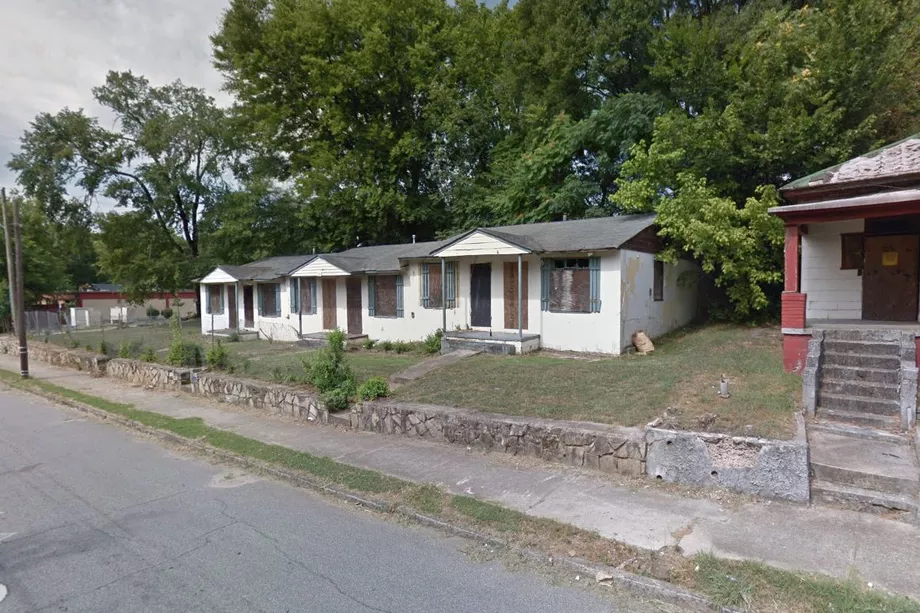
From the 1970s onward, the neighborhoods suffered steep declines. White flight, suburbanization, and weak public investment hollowed out the community fabric. Vine City’s public housing deteriorated; English Avenue became known as “The Bluff,” infamous for crime and drug trade.

By the 1990s, foreclosures, abandoned homes, and environmental threats (such as flooding and lead-contaminated soil from slag) compounded the distress. In 2006, a tragic no‑knock raid killed Kathryn Johnston, an elderly Black woman, sparking outrage and scrutiny of police tactics.

Revitalization Efforts & Preservation

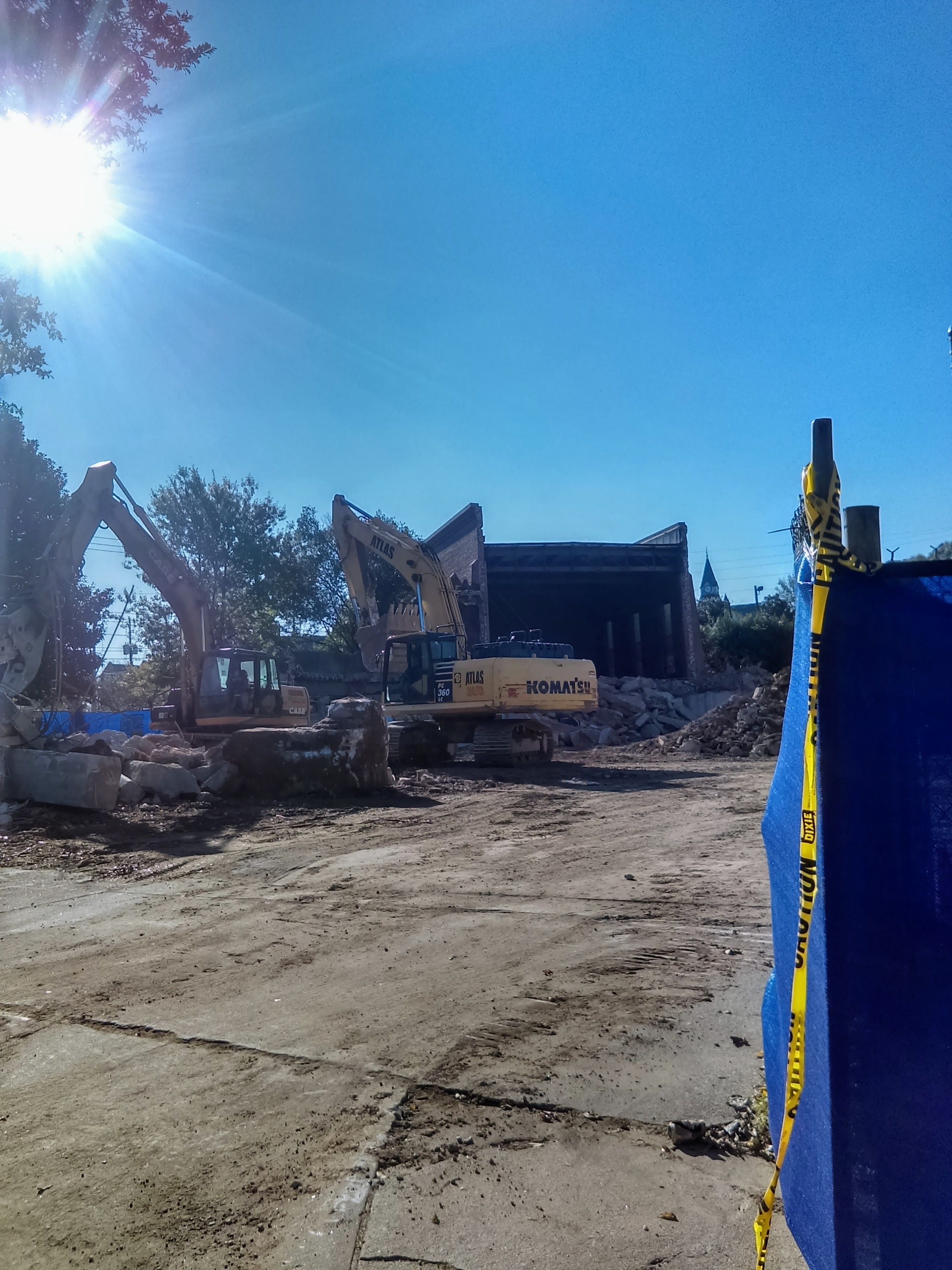
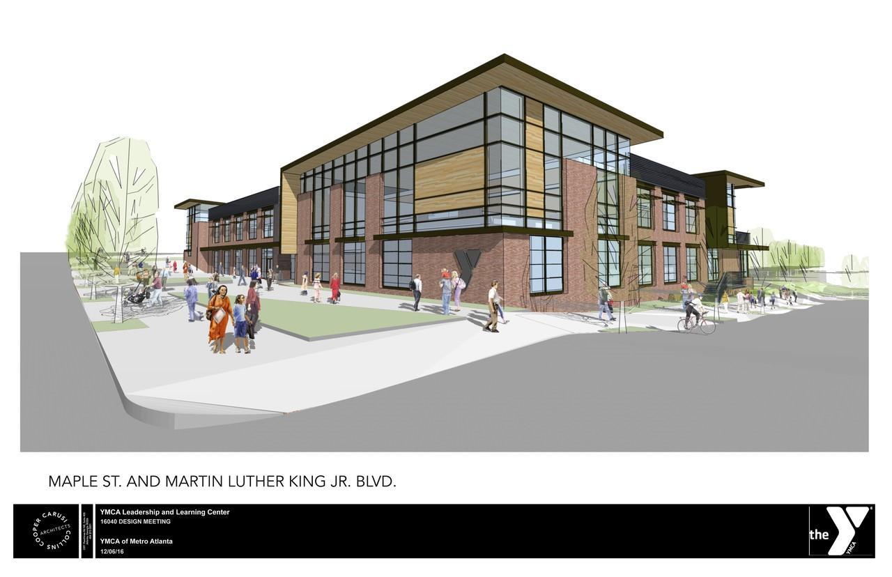
Since the late 1990s, public funding—like Atlanta’s Westside Tax Allocation District—has injected millions into redevelopment, though results have been uneven. Grassroots and faith-based organizations play leading roles today. Community-led CDCs, like those tied to churches, push affordable housing and local services, often up against speculation and embattled land ownership.

Notable infrastructure examples: Lindsay Street Park (opened 2015) brought greenspace to English Avenue. Kathryn Johnston Memorial Park (opened 2019) addressed flooding while serving as a tribute to her memory.

Historic preservation is gaining momentum. The English Avenue School was listed on the National Register of Historic Places in 2020, with plans to convert it into a community center. Likewise, St. Mark AME Church—a landmark in English Avenue—is receiving protection to stave off demolition and possibly become a restored civic hub.


Then & Now

EraVine CityEnglish Avenue
Early 1900sBlack prosperity, cultural eliteWhite working-class, segregated
Mid-centuryCivil rights ties, strong Black communityTransition to Black middle class, civic potential
Late 20th c.Disinvestment, blight, public housing decayCrime, poverty, boarded homes, environmental threats
21st centuryStadium development pressures, fragile revitalizationCommunity-led parks, preservation over demolition

Legacy, Resistance, and Hope

Vine City and English Avenue illustrate the tragic arc of segregation-era prosperity, mid-century civic power, and subsequent decline under systemic racism, redlining, and neglect. Yet their story is far from static. Grassroots activism, environmental justice, historic preservation, and community-driven development all offer pathways toward equitable revitalization.

These neighborhoods embody both the scars of past policies and the enduring strength of community. Recognizing that progress can be a delicate balance between preserving identity and enabling growth is key to honoring what Vine City and English Avenue have always represented—resilience, history, and hope.


Institutional Timeline: Vine City & English Avenue

To further enrich our comparison, here is a historical timeline of key institutions and developments shaping the two neighborhoods. It highlights how institutions rose, faltered, and, in some cases, found renewed purpose.

Year / PeriodVine CityEnglish Avenue
Late 1800s–1910sResidential development and early Black prosperity, including Alonzo Herndon building his home (1910) WikipediaWestern Heights (renamed English Avenue)—school built in 1910 for white students Wikipedia+1
1920s–1940sGrowth due to displacement from 1917 fire; racial jump across Simpson Road despite violence WikipediaContinued overcrowding in school due to demographic shift Wikipedia+1
1941–1951Opening of Eagan Homes and Herndon Homes public housing, increasing Black population WikipediaEnglish Avenue Elementary School re-designated as a Black school (1951) Wikipedia+1
1950s–1960sMartin Luther King Jr. moves to Vine City (1967); vibrant Black middle class community WikipediaPaschal’s Restaurant opens (1947), serving as a civil rights hub Wikipedia
1960School bombed (most severe racial incident in area) Wikipedia+1
1970s–1980sDecline of public housing and community cohesionNeighborhood becomes “The Bluff,” marked by abandonment and crime Wikipedia
1995English Avenue School closes Wikipedia
Late 1990s–2000s“Historic Westside Village” mixed-use development announced (1999), ultimately faltering; replaced by Walmart in 2013 Wikipedia
2006Kathryn Johnston killed in police raid, sparking outrage and reforms Wikipedia+1
2015Lindsay Street Park opens—the first public park in the neighborhood Wikipedia
2019Kathryn Johnston Memorial Park opens to mitigate flooding and honor her memory Wikipedia
2020English Avenue School listed on National Register of Historic Places Wikipedia
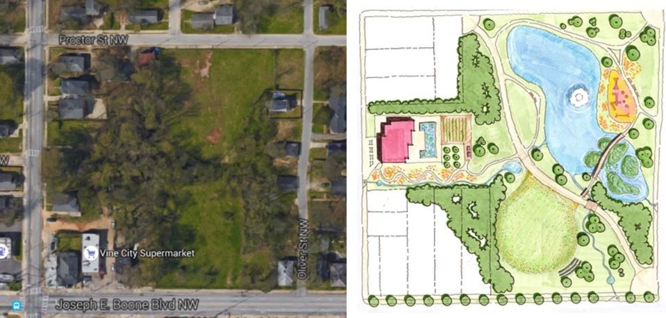
2020sOngoing redevelopment efforts guided by Vine City Redevelopment Plan (2004), supported via tax allocation and community groups YUMPUMajor affordable housing and mixed-use projects (e.g., Herndon Square, Proctor development) launching near BeltLine; developer interest growing Urbanize Atlanta

Better Late than Never: 2025 is the Year of Atlanta’s Historic Westside Core

Seven years ago, while living in the West End, I started this blog. Excited by the number of new residents moving in, businesses opening, and the surging homes prices for homes being renovated in the area, I wanted a way of documenting the progress. Then I moved to New Orleans, and then Miami, and then Baltimore. And finally, in 2022, I returned to Atlanta, and last August, I began renovated a 1920s bungalow in English Avenue. I am amazed at the progress of the historic neighborhoods west of Downtown Atlanta.

So here’s a rundown of where I see things in 2025:

English Ave & Vine City

Vince City is benefitting from the development projects in the Gulch, the revitalization of MLK Drive, and major development projects along Boone Blvd including new a slew of new housing under construction. Rodney Cook Park, the entrance to the Beltline Westside Connector, and the new Insignia Hilton Hotel will help to soften the transition from Ivan Allen Jr. Blvd to Joseph E. Boone Blvd at Northside Drive.

Two of the most exciting projects I see are The Simpson, a 139 unit mid-rise apartment building which is being erected at 810 & 840 Boone Blvd, and a mixed-use development across the street at 839 Joseph E. Boone, which will include 33 units of multifamily and 1200 square feet of retail space.

English Avenue is BOOMING! One of the most exciting projects is the Modern Westside Trail which is coming alive on North Avenue and Northside Drive. This midrise apartment building is almost done, and will feature 373 studio, one, two and three-bedroom homes, and feature “expedient access to the Westside Trail of the Atlanta BeltLine and the various eclectic attractions within West Midtown.” Just next door to the Modera will be Avenue, a new restaurant/bar/lounge concept, Sibi Chalil Cherian, who also owns Vision Lounge.

English Avenue is also benefiting from developments along the Beltline like Echo Street West and Westside Motor Lounge, and the westward expansion of Georgia Tech called Science Square, and the redevelopment of the former Herndon Homes public housing project with new mixed income and senior housing called Herndon Square. As part of this redevelopment, a new supermarket is slated to be built at the corner of Cameroon Alexander Blvd and Northside Drive.

AUC, Ashview Heights & Washington Park

I’ve always been fond of Washington Park. When I was a student at Morehouse College, I tutored at Washington High School and lived in a boarding house next the white store on Ashby Street. I would walk past street walkers and grim reapers to get two filet-o-fish from Mcdonald’s on MLK and Lowery Blvd. I remember going to a Black Greek picnic in Washington Park. I remember when the Walmart was a Publix and the original Pascal’s Motor Hotel was still open. Before it closed completely, Clark Atlanta University used it as an overflow dorm for its students. So, I’ve seen the FULL progression of the area.

When I last lived in Atlanta, the Beltline’s Westside trail stopped at Lena Street, right in front of Washington Park, but there’s new a section between Lena Street and Mayson Turner that just opened, and construction is underway to connect the trail to existing segments and bring this section of the Westside into the fold. This northern segment runs for about 1.3 miles, starting from the existing Westside Trail terminus at Lena Street and extending north to Law Street, where it will tie into Westside Trail—Segment 3 and the Westside Beltline Connector.

The Walmart has reopened; I’m still not a fan. This stretch of MLK, with all its storefronts has so much potential. In the near future, I expect it to have the feel of an Edgewood Ave where AUC students, neigborhood residents, and visitors can eat, stroll, and shop. This corridor is within walking distance to the Mercedes Benz Stadium, and could be an asset during the World Cup in 2026.

West End & Westview

Sadly, the West End Mall has finally closed. I remember shopping at Maxway and going to the RadioShack all the way at the end. The American Deli in the West End Mall was not to be played with! But the redevelopment of this parcel has been a plan for a looooooooong time. So, what’s to come is new live, work, play development called “One West End.”

According to the developers, One West End will be a mixed-income, mixed-use development. Commercial space will include: 125,000 square feet of retail, with a grocery store, fitness center, food & beverage experiences, and local boutiques. Residential space will include: 800+ rental and student-targeted housing units; mixed-income rental housing, with 70% workforce and 30% affordable; and a hotel. Community amenities will include a public green space, fitness center, resident lounge, and bike parking. The multi-year redevelopment process is expected to begin in 2025, with Phase One completion slated for 2028.

In my next post, I’ll break down what I see happening in Mechanicsville, Pittsburgh, Castleberry Hill and South Downtown.

Atlanta City Council Adopts Historic Westside Masterplan

The City of Atlanta  has made yet another landmark move in support of mixed-income growth and community retention on Atlanta’s Historic Westside.

Last week, the Atlanta City Council unanimously approved the Westside Land Use Framework Plan – a design and implementation strategy for the equitable revitalization of the historic Westside neighborhoods of English Avenue, Vine City, Ashview Heights, Atlanta University Center, Booker T. Washington and Just Us. It was sponsored by the Westside Future Fund, City of Atlanta and Chick-fil-A Foundation.

Historic-Westside-Village-e1470160210329

Recently built Historic Westside Village townhomes sit just behind the new Vine City Chick-fil-a and MLK Walmart.

The plan, which will help guide future developments, was introduced by District 3 and 4 Councilmembers Ivory Young and Cleta Winslow and championed by fellow councilmember and Westside native Michael Julian Bond (Post 1 At-Large).

“As a longtime Westside resident and steward of the community, I am encouraged by the support we received from our City’s leadership to adopt this very important plan, which will serve a catalyst for the revitalization of my entire City Council district,” said Councilmember Young whose district-wide Westside Revive plan includes the Land Use Framework Plan.

“The history, culture and people that exist in these neighborhoods cannot afford to be lost or compromised. This plan will allow us to oversee positive change and guide these neighborhoods to become ‘whole’ and vibrant again.”

Screen Shot 2017-12-10 at 3.57.39 PM

Westside Future Fund commissioned the plan in 2015 – less than a year after its founding – as one of its first orders of business. Plan principles include:

• Grounding in best practice and existing community knowledge: Renowned urbanist Dhiru Thadani and Atlanta-based firm APD Urban Planning and Management were hired to lead the project, which coupled best-practice research of other successful and similar community revitalization projects with extensive consideration of how to link past planning efforts.

The recommendations built upon the 18 previous plans and studies that were completed in the past 15 years, including the City’s most recent Atlanta City Design Project, created by City of Atlanta Planning Commissioner Tim Keane and Atlanta BeltLine visionary Ryan Gravel.


  • Robust Community Engagement Process: Community engagement meetings with all neighborhoods were conducted over the course of a year and a half, beginning spring 2016, with each neighborhood providing input on a unique vision statement and goals.More than 1,000 stakeholders participated in the process, including all six neighborhood associations and the Atlanta University Center institutions (Morehouse College, Spelman College, Clark Atlanta University, Morris Brown and Morehouse School of Medicine).
  • Focused Vision for Resident Retention, Neighborhood Character, Infrastructure and Parks and Open Space.


The adoption of the Framework Plan comes just weeks after Council’s unanimous approval of the Mandatory Inclusionary Zoning Legislation, which supports the creation of quality, affordable mixed-income housing – a key component of the plan.

The new zoning law requires new rental housing developments in BeltLine communities, such as the Historic Westside District, to set aside  at least ten percent of units for affordable “workforce housing” which is being defined as 60 percent Area Median Income (AMI)* or below OR 15 percent of its total units for households at 80 percent AMI or below.

“We are extremely grateful for the leadership of Mayor Kasim Reed, Commissioner Tim Keane and his team and Atlanta City Council to ensure that all residents — no matter their background or socioeconomic status — have an opportunity to be part of the tremendous growth and revitalization that’s happening in our city,” said John Ahmann, executive director of the Westside Future Fund.

“These two actions are critical and important first steps, but only the beginning. We must continue to be intentional about creating opportunities for individuals who still find themselves below the current threshold,” Ahmann added. “As the birthplace of Civil Rights leaders and the adult home of Dr. King, we have great responsibility to carry on their legacy. Westside Future Fund is dedicated to fostering a community they would still be proud to call home. One that is compassionate, inclusive and economically just.”

Of the 6,300 current historic Westside households, 90% are renters. Of that number, more than 70% fall below the qualifying AMI, earning on average less than $15,000 annually and often occupying notoriously sub-standard housing.


Since the establishment of the Westside Future Fund in Dec. 2014 by Mayor Reed and the Atlanta Committee for Progress, the organization has focused on ensuring the historic Westside develops as a mixed-income community, not displacing current residents, while also creating housing options for future residents of all income levels, especially as planned growth and development across the city foreshadow a higher demand for intown real estate.

According to Atlanta City Design Project, the City’s population is expected to grow to 1.2 million people by 2050, nearly triple the city’s current size.

  • In 2016, Westside Future Fund led the development of a community retention plan, created to specifically address Westside residents’ (homeowners and renters) concerns about displacement and gentrification.The plan is a complement to the Land Use Framework Plan, outlining recommendations and strategies to address the concerns expressed during the community engagement period. Partners in the collaboration were City of Atlanta’s Department of Planning and Community Development, the Arthur M. Blank Family Foundation, Atlanta Housing Authority, Invest Atlanta, Atlanta Beltline and Atlanta Habitat for Humanity.

    This collaborative of public-private entities, along with organizations within the nonprofit sector, are considered potential implementation partners of the strategy as well.

  • Back in April, Westside Future Fund, in partnership with Mayor Reed and the City of Atlanta, announced one of the first initiatives of the strategy – the Anti-Displacement Tax Fund, which will pay property tax increases for the next 20 years for current, qualifying homeowners.For renters, however, the solution has been more complex.

    As part of its strategy for providing better quality of life for renters, Westside Future Fund lobbied for the Westside’s four historic neighborhoods to be included in the new legislation, but acknowledges the long road ahead toward guaranteeing high quality, affordable options for all.

    “To be successful at ensuring legacy residents are not displaced and can benefit from the current and future development, it will take collaboration across the public, private and nonprofit sectors,” said Ahmann. “Leveraging philanthropy to bridge this disparity is our greatest opportunity, and we’ll be calling upon the Atlanta community to help us address this need.”

    The inclusionary zoning policy will go into effect on all developments seeking a permit 60 days from the Nov. 7 City Council meeting date.

    The Land Use Framework Plan will now be incorporated into the City’s Comprehensive Development Plan, ensuring its recommendations are factored into future planning decisions.

Demolition of a Portion of Morris Brown’s Campus Underway for New $20 Million YMCA in Vine City

Demolition is underway in the northwestern most section of the historic Morris Brown College campus. The former Jordan Hall, which sits at the corner of MLK Drive and Maple St and was once home to the College’s gymnasium, is being transformed into the new $20 million home of the YMCA of Metro Atlanta.


IMAG0764

Last year, the YMCA purchased the property from the City of Atlanta. Morris Brown sold off much of its assets to satisfy a multi-million dollar debt and Chapter 11 bankruptcy.

The school has since emerged from that phase and is on the path to recovery.

new_YMCA

Once completed, the building will also house the Leadership and Learning Center which will offer early learning opportunities to about 70 Vine City youth.

The building is being only partially demolished after residents, community leaders, and curators of black culture pushed for the preservation of the historic structure. It began as the Edmund Asa Ware Elementary School, one of the first schools in the city to educate African-American students.

The YMCA hopes to move into its new building by the summer of 2018.

Several New Affordable Homes Headed for English Avenue

After the successful construction of 5 affordable homes along James P. Brawley Dr. NW in Vine City earlier this year (Phase I), the Atlanta Police Foundation has embarked on an even more ambitious project in neighboring English Avenue. In Phase II, a total of 20 newly constructed homes are planned for police officers and long-time neighborhood residents.

Griffin_Street_Apartments

Blighted apartments on Griffin Street have been demolished for new construction.

Demolition has already been completed of previously dilapidated homes and work is underway on Griffin Street to build several new homes for police officers and legacy residents, according to the Atlanta Police Foundation. The initiative, known as Secure Neighborhoods, is supported by the City of Atlanta, the Arthur M. Blank Family Foundation, and Westside Future Fund and is targeted towards three specific neighborhoods: Vine City, English Avenue, and Pittsburgh.

14657314_1843128382583026_3256136458837894640_n
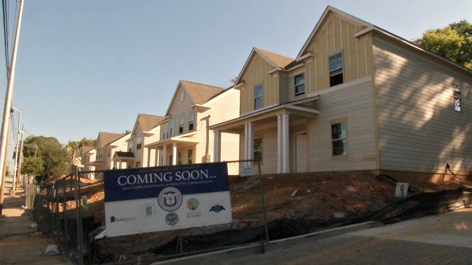
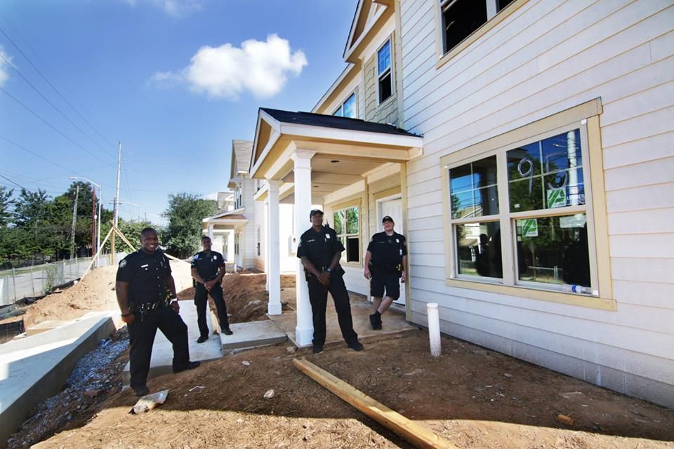
In addition to removing blight and adding new residents to the Historic Westside communities, the Secure Neighborhoods programs seeks to increase police visibility, build connections between police and neighbors, and provide housing options for officers.  And its already seeing success; the Westside has seen a significant reduction in crime.

The organization is based on a public-private partnership model that has worked to secure and leverage private resources to fund high priority projects designed to enhance the City of Atlanta’s ability to fight and prevent crime. As a result of the work of the APF, since 2003 there has been an increase in the number of police officers on the streets and an increase in the engagement of Atlanta’s business community and neighborhood residents in fighting crime. Additionally, the City has experienced a 58 percent reduction in the violent crime rate and a 41 percent reduction in crimes overall.

14720542_1843136982582166_3560788328946588158_n

Another 10 homes are expected to be built as part of phase III in 2018. By 2020, the project will have constricted 35 new homes in downtown west.


Another New Park to Be Built in Vine City

It is being reported that a 4 acre park, Boone Park West,  will be built in Vine City.  This is the second park to be announced this year.  This past spring construction began on the Rodney Cook Sr. Park.

Boone Park West Compile (1).JPG

Boone Park West sit at the intersection of Oliver St. NW and Joseph E Boone Blvd. 

Construction of Boone Park West  will include the conversion of  a collection of abandoned and neglected parcels into a “positive, vibrant, and transformative public space” that engages the community in green infrastructure solutions, increases public access to recreational opportunities, provides jobs and training for residents, improves environmental quality, and reduces negative impacts of stormwater runoff, according to a report by Park Pride.

Curbed Atlanta and Saratoga Report both reported that the plans to create Boone Park West in the Proctor Creek Watershed. The plans show the proposed site will carve out space for the future home of the Atlanta Urban Ecology Resource Center (AUERC).

The new park is just one of many within the watershed that could help address issues of flooding in neighborhoods like English Avenue and Vine City. One of the primary purposes of Boone Park West is to control localized flooding around the park site and provide capacity relief for the sewer system around this westward edge of Downtown  Atlanta.

According to Park Pride officials, the park will be the third on the westside (after Vine City Park and Lindsay Street Park) built as part of the Proctor Creek North Avenue Vision for Green Infrastructure study completed in 2010.

Said officials in a release: “A key component of Boone Park West will be a green infrastructure amenity designed to capture, clean, and infiltrate at least 37,500 cubic feet of stormwater runoff from the surrounding streets, mitigating the recurrent flooding that has historically plagued these neighborhoods.”